Glen of Aherlow: Walking Trails Between the Galtees and Slievenamuck
The Glen of Aherlow is a valley in south County Tipperary that sits between the Galtee Mountains to the south and the Slievenamuck ridge to the north. It barely features on the tourist circuit. That is its appeal. This is walking country - proper walking country - with eight waymarked trails on Slievenamuck and access routes into the Galtees, Ireland's highest inland mountain range.
The valley floor is farmland and forest. A statue of Christ the King stands on the Slievenamuck ridge overlooking the glen, and the views from there across to the Galtees are among the best panoramas in Munster. The Glen is about 15 minutes from Cahir and 30 minutes from the Rock of Cashel.
If you are interested in walking, the Glen of Aherlow is one of Tipperary's strongest reasons to stay longer than a day trip.
What to Expect
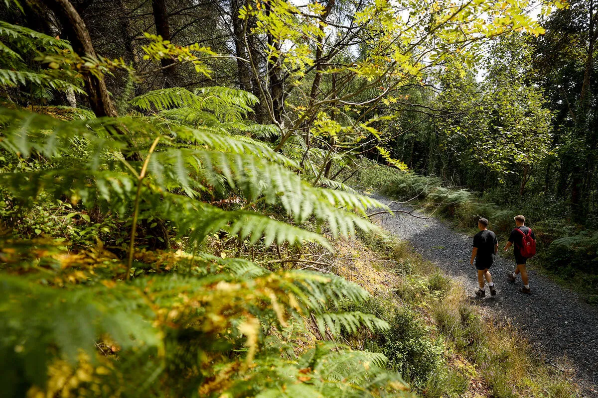
The Christ the King trailhead on Slievenamuck is the main starting point. Five waymarked loops leave from here, ranging from the easy Woodland Walk (2 kilometres, 30 to 60 minutes) to the moderate Rock an Thorabh loop (6 kilometres, 2.5 hours). The trails mix forest track and open moorland. The views from the ridge across to the Galtees are the consistent reward.
The Ballinacourty loop is the best of the Slievenamuck walks - 8 to 10 kilometres, two to three hours, with 240 metres of ascent. It follows purple waymarking through forest and moorland with views into the glen and across to the mountains. The surface is mixed - forest road, grass track, and some boggy sections. Proper walking boots are advisable.
The Galtee Mountains are the bigger draw for experienced walkers. Galtymore, the highest peak at 919 metres, is accessed from Clydagh Bridge on the south side of the glen. The clockwise circuit via Lough Curra is the classic route - about 15 kilometres with serious ascent. The corrie lakes are dramatic. The ridge walking is exposed. This is a proper mountain day that demands respect and good weather.
The valley itself is peaceful. You can cycle the quiet roads, fish the River Aherlow for brown trout without a permit, or ride horses at one of the local equestrian centres. The pace is slow. The scenery is consistently good without any single blockbuster moment.
The honest negative: the glen is remote. There are no towns of any size in the valley - just scattered farms, a few B&Bs, and the Aherlow House Hotel. If you want evening entertainment, you need to drive to Cahir or Tipperary town. The trails are well-marked but not heavily maintained - fallen trees and overgrown sections are possible. And the Galtees are real mountains with real weather. Cloud, wind, and rain can arrive without warning.
How to Get There
The Glen of Aherlow is about 15 minutes south of Tipperary town and 15 minutes west of Cahir. From the N24 (Limerick-Waterford road), turn south at Bansha. The Christ the King trailhead is well signposted from the R663.
There is free parking at the main trailheads. The Christ the King car park has map boards and space for about 20 cars. It rarely fills outside bank holiday weekends.
There is no public transport into the glen. You need a car. The nearest bus and train connections are in Cahir or Tipperary town.
Where to Stay Nearby
The Aherlow House Hotel is the only hotel in the glen itself. Cahir and Tipperary town both have more options and are 15 minutes away. See the full County Tipperary guide for the wider picture.
The only hotel in the glen. Mountain views, decent food, and walking trails from the front door. The natural base for the area.
Check availability →What Else is Nearby
A Note on the History
The Glen of Aherlow has a violent history. It was a stronghold of the O'Brien clan and later a refuge for dispossessed Irish during the Cromwellian period. The Galtee Mountains were used as hideouts during the Land War and the War of Independence. The Christ the King statue, erected in 1950, overlooks the valley from Slievenamuck.
The Galtees are geologically interesting - sandstone mountains capped with conglomerate, shaped by glaciation into corrie lakes and U-shaped valleys. Galtymore at 919 metres is the highest point in Ireland outside Kerry and Wicklow.
Frequently Asked Questions