The Burren: A Practical Guide to Clare's Lunar Landscape
The Burren is 350 square kilometres of karst limestone that looks barren from the road and turns out to be one of the most botanically rich landscapes in Europe. Arctic and Mediterranean plants grow side by side in the cracks of the rock - something that happens nowhere else on earth. Neolithic tombs sit on hilltops. Holy wells hide in valleys. The whole thing looks like the surface of the moon with wildflowers.
Most visitors drive through the Burren on the way to the Cliffs of Moher and see it as grey rock through a car window. That is like visiting a library and only looking at the building. The Burren rewards getting out of the car and walking. Even a 30-minute stroll across the limestone reveals flowers, fossils, and a silence that is genuinely rare in County Clare.
What to Expect
The Burren National Park has its main access point at Gortlecka Crossroads, reached from Corofin. A free shuttle runs from the Corofin Information Point in summer (every 30 minutes, May to September). The trails from Gortlecka range from easy 30-minute loops to 3-hour moderate walks across open limestone.
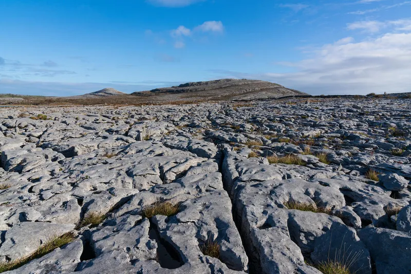
Walking on the Burren is unlike anywhere else in Ireland. The ground is flat limestone pavement cracked into blocks called clints. The cracks between them - grikes - are where the flowers grow. In May and June the display is extraordinary. Spring gentians, mountain avens, bloody cranesbill, and orchids all growing from bare rock. Botanists come from across Europe to see it.
Beyond the National Park, the Burren stretches north to Ballyvaughan and the coast. The area around Fanore has beaches backed by limestone. The green roads - ancient tracks across the uplands - are some of the best walking in Ireland. Quiet, unpaved, and leading to views that open up without warning.
The Burren Centre in Kilfenora has exhibits on the geology, flora, and human history. It is a good starting point if you want to understand what you are looking at before you walk. The village itself has a 12th-century cathedral with unusual stone carvings and a high cross in the churchyard.
The honest negative: the Burren in rain is bleak. The limestone turns dark grey and the flowers close up. It is still interesting but nothing like a sunny day. Also, navigation off the marked trails is genuinely challenging - the rock all looks the same and there are few landmarks. Stick to waymarked routes unless you are experienced with map and compass.
How to Get There
From Ennis, the Burren is about 30 minutes north via the R476 to Corofin or the N85 to Ennistymon and then the R481. From Galway, it is about 45 minutes south via the N67 through Ballyvaughan.
A car is essential. Bus Eireann routes 333 and 350 pass through the edges but the heart of the Burren is accessible only by car or on foot. The free summer shuttle from Corofin to the trailhead helps once you are in the area.
Where to Stay Nearby
Ballyvaughan on the north coast is the natural base for the Burren - small, scenic, and central. Ennis and Doolin are alternatives. The County Clare hub covers all options.
Country house hotel at the foot of Corkscrew Hill. Views over the Burren to Galway Bay. Exceptional food. One of Ireland's best small hotels.
Check availability →What Else is Nearby
A Note on the History
The Burren has been inhabited for at least 6,000 years. The density of archaeological sites is remarkable - over 90 megalithic tombs, 500 ring forts, and numerous holy wells and early Christian sites in an area the size of a small English county. Poulnabrone Dolmen is the most famous but there are dozens more, many unmarked and unvisited.
The landscape you see today is not natural. It was forested until Neolithic farmers cleared the trees and the thin soil washed off the limestone, leaving bare rock. The Burren is essentially a 6,000-year-old environmental catastrophe that turned out to be botanically extraordinary.
Frequently Asked Questions