The Glens of Antrim: Nine Valleys You Drive Past Too Quickly
Nine glens run from the Antrim plateau down to the coast between Larne and Ballycastle. Each has its own character - waterfalls, forests, villages tucked into valley floors. Most visitors drive the coast road between Belfast and the Giant's Causeway and see the glens as green blurs through a car window. That is like reading the chapter headings and skipping the book.
The A2 coast road through the glens is one of the finest drives in Ireland. But the glens themselves reward stopping. Glenariff has a waterfall walk that is among the best short hikes in County Antrim. Cushendall and Cushendun are two of the prettiest villages on the island. The pace here is different from the Causeway coast - slower, quieter, and less tourist-focused.
What to Expect
Glenariff is the Queen of the Glens and the one to prioritise if time is limited. The forest park has a 3-kilometre waterfall walk that follows a gorge through native woodland. Three waterfalls cascade through the glen - the boardwalks and viewing platforms bring you close to the water. The walk is graded moderate with steps and some uneven ground. Allow 1.5 to 2 hours at a comfortable pace.
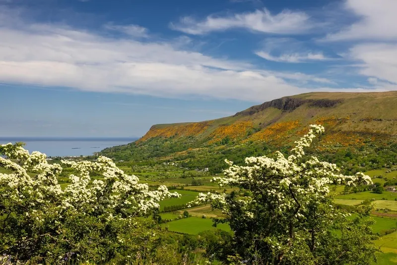
The coast road from Larne to Ballycastle is about 60 kilometres and passes through or near all nine glens. Glenarm is the first you reach heading north from Belfast - a planned village with a castle estate and good restaurants. Carnlough has a harbour and the Londonderry Arms, a coaching inn once owned by Winston Churchill's family.
Cushendall is the unofficial capital of the glens. A crossroads village with coloured shop fronts, a sandy beach, and the Curfew Tower in the centre. Cushendun, a few kilometres north, has a distinctive look - whitewashed Cornish-style cottages designed by Clough Williams-Ellis (who also created Portmeirion in Wales). The caves at Cushendun were used as a Game of Thrones filming location.
North of Cushendun, the coast road climbs to Torr Head - the closest point on the Irish mainland to Scotland. The road is narrow and winding but the views across the Sea of Moyle to the Mull of Kintyre are extraordinary on a clear day.
The honest negative: in poor weather the views disappear entirely and the waterfall walk becomes a mud bath. The glens are best on a dry day with some cloud - full sun can flatten the landscape and heavy rain makes the forest paths slippery. Public transport through the glens is effectively non-existent. Without a car you will see very little.
How to Get There
Glenariff Forest Park is about 45 minutes from Belfast via the A26 and A42. The coast road from Larne (30 minutes from Belfast) to Ballycastle covers all nine glens in about 60 kilometres.
A car is essential. There is no useful public transport through the glens. The most scenic approach is the A2 coast road northbound from Larne - the sea is on your right and each glen opens up to the left as you drive.
Where to Stay Nearby
Cushendall is the best base for the glens - central, scenic, and with enough accommodation. Carnlough and Cushendun are alternatives. The County Antrim hub has the full picture.
Historic coaching inn on the harbour. Once owned by the Churchill family. Solid food, comfortable rooms, and a good base for the southern glens.
Check availability →What Else is Nearby
A Note on the History
The nine glens have been inhabited for thousands of years. The name Antrim comes from the Irish Aontroim, meaning lone ridge - a reference to the basalt plateau that the glens cut through. The Scots-Irish connection is strong here. For centuries, the short sea crossing to Scotland meant the glens had closer ties to the Scottish Highlands than to the rest of Ireland.
The coast road was engineered in the 1830s as a famine relief project. Before that, the glens were accessible only from the sea or over the mountain tops. The road opened up the area but the glens retained their sense of isolation. Even today, the upper reaches of some glens feel genuinely remote.
Frequently Asked Questions