The Barrow Way: Walking & Cycling the Carlow Towpath
The Barrow Way is a 114-kilometre waymarked trail that follows the River Barrow from Robertstown in County Kildare to St Mullins in County Carlow. The full route takes four to five days. Most people do not walk the full route. The section worth your time is the Carlow stretch - from Bagenalstown south to St Mullins, roughly 32 kilometres of towpath along one of the most beautiful river valleys in Leinster.
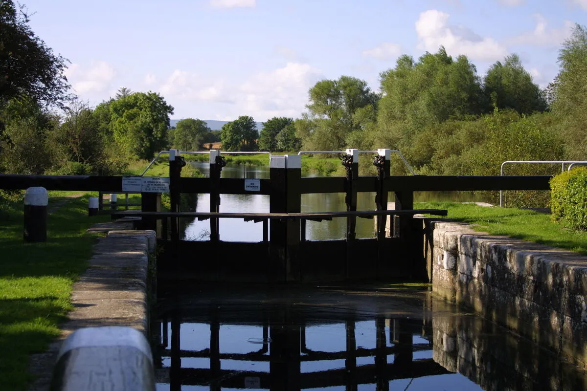
This is flat walking and cycling along an old canal towpath. No hills, no scrambling, no navigation decisions. Just the river, the locks, the herons, and the occasional village. The path is grassy in places and can be soft after rain, but the surface is manageable for walking and hybrid or gravel bikes. It is not a wilderness trail. It is a towpath with centuries of human use built into it - stone locks, lifting bridges, weirs where the canal meets the river. The Barrow was once a commercial waterway and the infrastructure is still there, quietly falling into photogenic decay.
What to Expect
The Carlow section breaks naturally into three stages. Bagenalstown (Muine Bheag) to Goresbridge is about 10 kilometres, flat and easy, passing through farmland with the river always in sight. Goresbridge to Graiguenamanagh adds another 16 kilometres and is the heart of the walk - the valley deepens, the trees close in, and you pass a sequence of stone locks where herons stand motionless in the shallows. Graiguenamanagh to St Mullins is the final 6 kilometres and the most scenic stretch, with steep wooded slopes above the river and views of Mount Leinster to the west.
The locks are a particular pleasure. There are 23 on the non-tidal Barrow, built in stone and timber with parallel weirs. Most are unmanned now but structurally intact. Fenniscourt Lock, near Bagenalstown, is one of the most photogenic. The lock-keeper's cottages are scattered along the route, some renovated, some not.
Graiguenamanagh is the natural halfway point and the best stop for food and drink. The town has a Cistercian abbey (Duiske Abbey, founded 1204) and a handful of pubs and cafes. If you are doing the walk over two days, this is where to stay overnight. The final stretch to St Mullins is the reward - the river widens, becomes tidal below the last weir, and the monastic village appears on the far bank.
For cyclists, the towpath is rideable on hybrid or gravel bikes. Road bikes are not suitable - the surface is grass and packed earth, not tarmac. The full Bagenalstown to St Mullins section takes three to four hours by bike.
How to Get There
Bagenalstown (Muine Bheag) is the most practical starting point for the Carlow section. It has a train station with services from Dublin Heuston (about 1 hour 40 minutes) and Waterford. The town is on the N9/R705, about 20 kilometres south of Carlow town.
The logistics challenge is the linear route. If you walk south to St Mullins, you need transport back. Options: arrange a taxi from St Mullins to Bagenalstown, leave a second car at St Mullins, or do an out-and-back section. Some walking holiday operators offer luggage transfer and pick-up services for multi-day walks. Graiguenamanagh also has limited bus connections.
If you are driving, there are car parks at Bagenalstown, Goresbridge, Graiguenamanagh, and St Mullins. The most popular short walk is Graiguenamanagh to St Mullins (6 km one way, about 1.5 hours), returning the same way or by taxi.
Where to Stay Nearby
For a day walk, you do not need accommodation - start and finish in Bagenalstown or drive to Graiguenamanagh for the short section. For the full two-day walk, stay overnight in Graiguenamanagh, which has B&Bs and a hotel. Bagenalstown has guesthouses and is on the train line.
What Else is Nearby
Frequently Asked Questions