Slieve Gullion: The Mountain at the Heart of South Armagh
Slieve Gullion is the highest point in County Armagh at 573 metres. The summit holds a passage tomb and a lake, the forest park at its base has one of Ireland's best adventure playgrounds, and the views from the top cover six counties on a clear day. It is the centrepiece of the Ring of Gullion volcanic landscape and the best reason to visit south Armagh.
The mountain is manageable rather than intimidating. The summit walk is about 10 kilometres round trip with a moderate climb. Families who do not want the summit have forest trails, a scenic drive, and the Giant's Lair playground. There is something here for every level of fitness and ambition.
What to Expect
The summit walk starts from the scenic drive car park and climbs steadily through open moorland. The path is well marked but rough underfoot - stone, peat, and bog. The last section steepens before the top opens out to reveal a small lake and the passage tomb beside it. The tomb is Neolithic, roughly contemporary with Newgrange, and the lake beside it is one of the highest in Ireland.
The views from the summit are the reward. On a clear day you can see Mourne Mountains to the east, Cooley Peninsula to the south, and across the midlands to the west. Six counties are visible. The sense of space is enormous for a mountain that sits at just 573 metres.
Below, the forest park is a different experience entirely. The Giant's Lair is a storybook adventure playground built around local mythology - Cuchulainn, Fionn mac Cumhaill, and the Calliagh Birra who guards the summit lake. It is exceptional for families. Children disappear into it for hours.
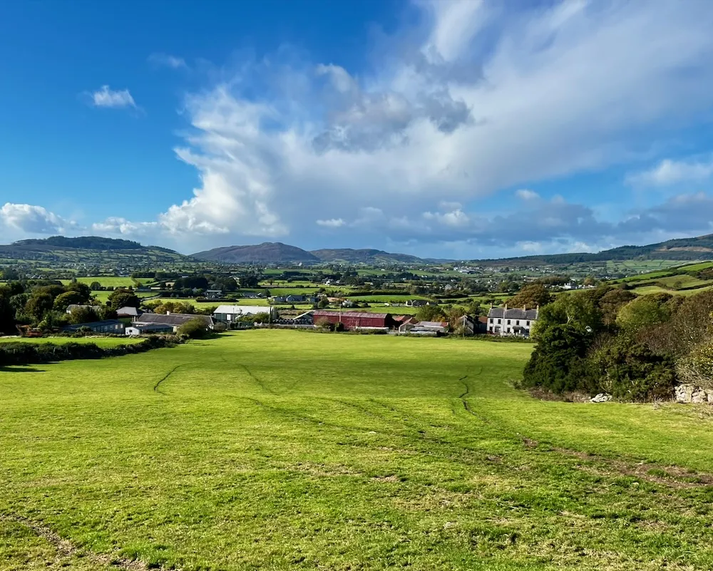
The scenic forest drive loops through the lower slopes with pull-in viewpoints. Walking trails of varying length start from both the main car park and the scenic drive. The cafe serves hot food and is a welcome sight after the summit.
The honest negative: the summit path is boggy even in summer. Proper walking boots are essential, not runners or trainers. Cloud cover eliminates the view entirely, and south Armagh gets more than its share of low cloud. Check the weather before committing to the summit walk. If the top is in cloud, stick to the forest trails.
How to Get There
Slieve Gullion Forest Park is 30 minutes south of Armagh city and about 1 hour 15 minutes from Belfast via the A1 through Newry. The park is well signposted from Newry and from the A1 motorway.
There is no public transport to Slieve Gullion. A car is essential. The roads from Newry are good. From the Dublin direction, take the M1 north to Newry and follow signs.
Where to Stay Nearby
Newry is the nearest town with a full range of accommodation. Killeavy Castle Estate at the base of the mountain is a luxury option. The County Armagh hub has the full picture.
Luxury hotel and spa at the foot of Slieve Gullion. Restored castle, excellent restaurant, and a geopark-themed tasting menu. The location is unbeatable for the mountain.
Check availability →What Else is Nearby
A Note on the History
Slieve Gullion is named from Sliabh gCuillinn - the mountain of the steep slope. In Irish mythology, the Calliagh Birra (the hag of Birra) guards the summit lake. The passage tomb at the top dates to approximately 3,000 BC, making it one of the highest megalithic monuments in Ireland.
The mountain was a stronghold of the O'Neill clan for centuries. South Armagh's history is layered and complex - Gaelic, Norman, plantation, and more recent history all leave their marks on the landscape. The Ti Chulainn Cultural Centre in nearby Mullaghbane celebrates the area's Irish language and cultural heritage.
Frequently Asked Questions