Sperrin Mountains: Northern Ireland's Emptiest Landscape
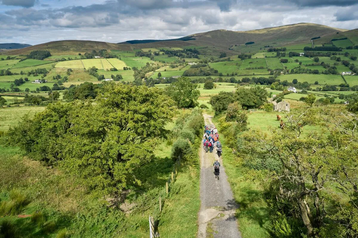
The Sperrin Mountains are the largest upland area in Northern Ireland and one of the emptiest landscapes on the island. They stretch across the border of County Derry and County Tyrone - rolling bog, heather, and skylines that seem to go on forever. The Sperrins lack the drama of the Mournes and the marketing budget of the Glens of Antrim. What they have is solitude. If you want to walk for hours without seeing another person, with big views in every direction and nothing between you and the sky, this is the place in Northern Ireland to do it.
What to Expect
The Sperrins are not a destination in the conventional sense. There is no visitor centre, no marked entrance, no ticket desk. They are a large area of upland moorland that you drive into, park at an informal lay-by, and walk.
The highest point is Sawel Mountain at 678 metres. The ascent from the Sawel Pass road is the most popular route - about 2-3 hours return. The terrain is bog and heather, pathless in places, with the summit marked by a trig point. The views from the top extend across Northern Ireland in every direction - the Mournes to the southeast, Donegal to the northwest, the Antrim plateau to the northeast.
For a less committed walk, Davagh Forest has marked trails through forestry and open moorland, and the OM Dark Sky Park and Observatory here is excellent for stargazing (book evening sessions in advance). The Beaghmore Stone Circles, accessible from a car park off the A505, are a remarkable Bronze Age site - seven stone circles, stone rows, and cairns in a boggy landscape. Free, always open, and usually deserted.
The terrain is the experience. Rolling bog, purple heather in late summer, curlews calling, skylarks above, and silence. The Sperrins do not photograph well - they are too subtle, too big, too empty to fit in a frame. You have to be there.
The honest negatives: the Sperrins are genuinely remote. There is no phone signal on higher ground. Navigation requires map and compass skills - in cloud, the moorland is featureless and disorienting. The terrain is boggy - waterproof boots are essential, not optional. Waymarking is poor to non-existent outside the forest parks. There is nothing to do here if you do not walk. And the landscape, while beautiful to those who appreciate emptiness, will disappoint anyone expecting dramatic peaks or scenic viewpoints with car parks.
How to Get There
The Sperrins are accessed from several directions. From Derry city, Dungiven (30 minutes southeast) is the northern gateway. From Belfast, Cookstown or Gortin (both about 1.5 hours) provide southern access.
There is no public transport into the mountains. A car is absolutely essential. Roads through the Sperrins are narrow, single-track in places, and can be blocked by sheep.
The Sawel Pass road (between Dungiven and Draperstown) provides the most accessible high-ground access. Davagh Forest is well-signposted from the A505 between Cookstown and Omagh.
The Belfast-Derry A6 road skirts the northern edge of the Sperrins through Dungiven - if you are driving between the two cities, a detour into the mountains adds an hour and is worth it if the weather is clear.
Where to Stay Nearby
Dungiven is the nearest base from the Derry side. Gortin and Cookstown serve the southern Sperrins. See the County Derry hub for accommodation in the north of the range.
Community-run centre at Carn, near Draperstown. Simple but well-positioned for the heart of the Sperrins.
Check availability →What Else is Nearby
A Note on the History
The Beaghmore Stone Circles date from the Bronze Age and were discovered in the 1940s when peat was cut for fuel during wartime. Seven stone circles, stone rows, and cairns emerged from the bog - a ritual landscape that had been buried for millennia. The alignment of the rows may relate to astronomical events, though this is debated.
The Sperrins were more densely populated before the Famine than they are now. Ruined farmsteads and lazy beds (ridged cultivation strips) are visible across the hillsides, evidence of communities that were cleared by starvation and emigration in the 1840s. The poet Seamus Heaney grew up on the eastern edge of the Sperrins, near Bellaghy, and the landscape of bog and farmland runs through his work.
Frequently Asked Questions